Atlantic and Great Lakes Sea Duck Migration Study
Project Number: 130
Investigators: Scott Gilliland (Acadia University and Canadian Wildlife Service; ), Keith McAloney, Jean-Pierre Savard (Environment Canada), Matthew Perry (USGS Patuxent Wildlife Research Center), Scott McWilliams (University of Rhode Island), Jay Osenkowski (Rhode Island Department of Environmental Management), Christine Lepage (Canadian Wildlife Service), Lucas Savoy (Biodiversity Research Institute, BRI), Dustin Meattey (BRI), Alicia Berlin, Ronald Therrien (USGS Patuxent Wildlife Research Center), Doug Howell (North Carolina Department of Wildlife Management), Shannon Badzinski (Canadian Wildlife Service), Phil Wilson (University of Western Ontario / Long Point Waterfowl), Scott Petrie (Long Point Waterfowl), Luke Fara (Southern Illinois University – Carbondale and USGS Upper Midwest Environmental Sciences Center), and Kevin Kenow (USGS Upper Midwest Environmental Sciences Center).
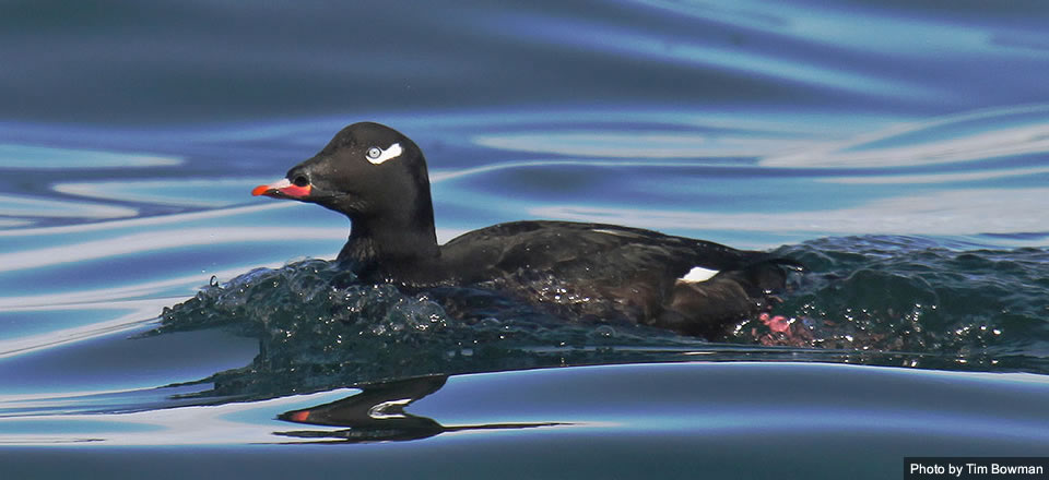
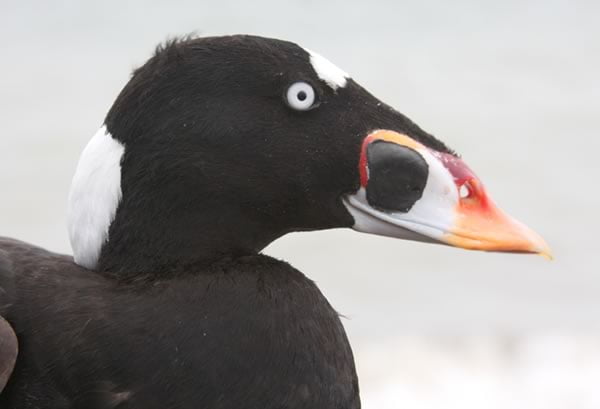
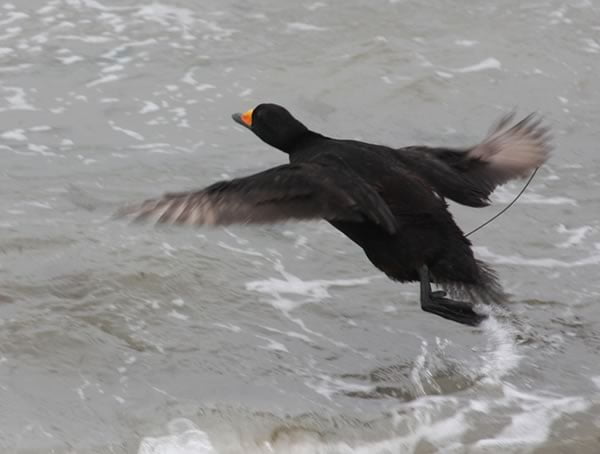
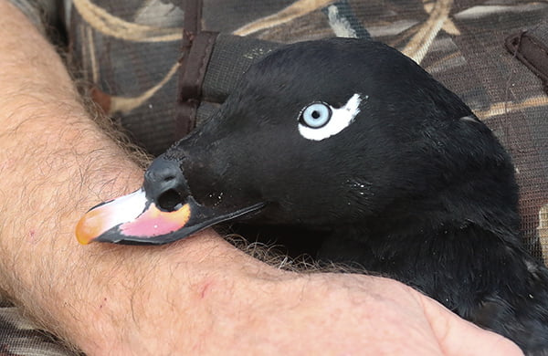
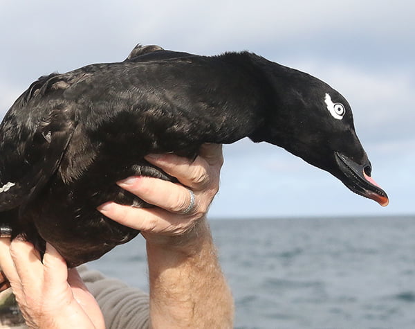
Focal Species: Black Scoter, Surf Scoter, White-winged Scoter, Long-tailed Duck
The Story
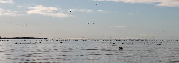
Most sea ducks breed at northern latitudes and winter in coastal, offshore, and major inland waters including the Great Lakes. Up until about 2009, progress had been made in population delineation (understanding the links among breeding, wintering, staging, and molting areas) of sea ducks in the Pacific and Arctic regions of North America, but relatively little had been done in the Atlantic and Great Lakes regions. Documenting sea duck migration patterns is key to understanding population ecology, declines, and the potential impacts of development, harvest, and climate change. Further, identifying key habitats used throughout the year also helps better inform habitat conservation efforts and aids in the design of monitoring programs for sea ducks.
As climate change becomes more evident, demands for alternative energy, including offshore wind power, are increasing. Another compelling reason for this study was to help identify near-shore and offshore areas of the Atlantic coast and Great Lakes where wind power facilities and other developments would have the least impact on sea ducks. Offshore wind farms have been proposed or already constructed in Nantucket Sound; coastal areas of Maine, Delaware, and Rhode Island; the north shore of Lake Ontario, and other areas, many of which harbor significant sea duck populations during winter. Sea ducks may use the same offshore areas proposed for development, prompting concerns about the displacement of birds, loss of habitat, and collisions with structures.
The Project
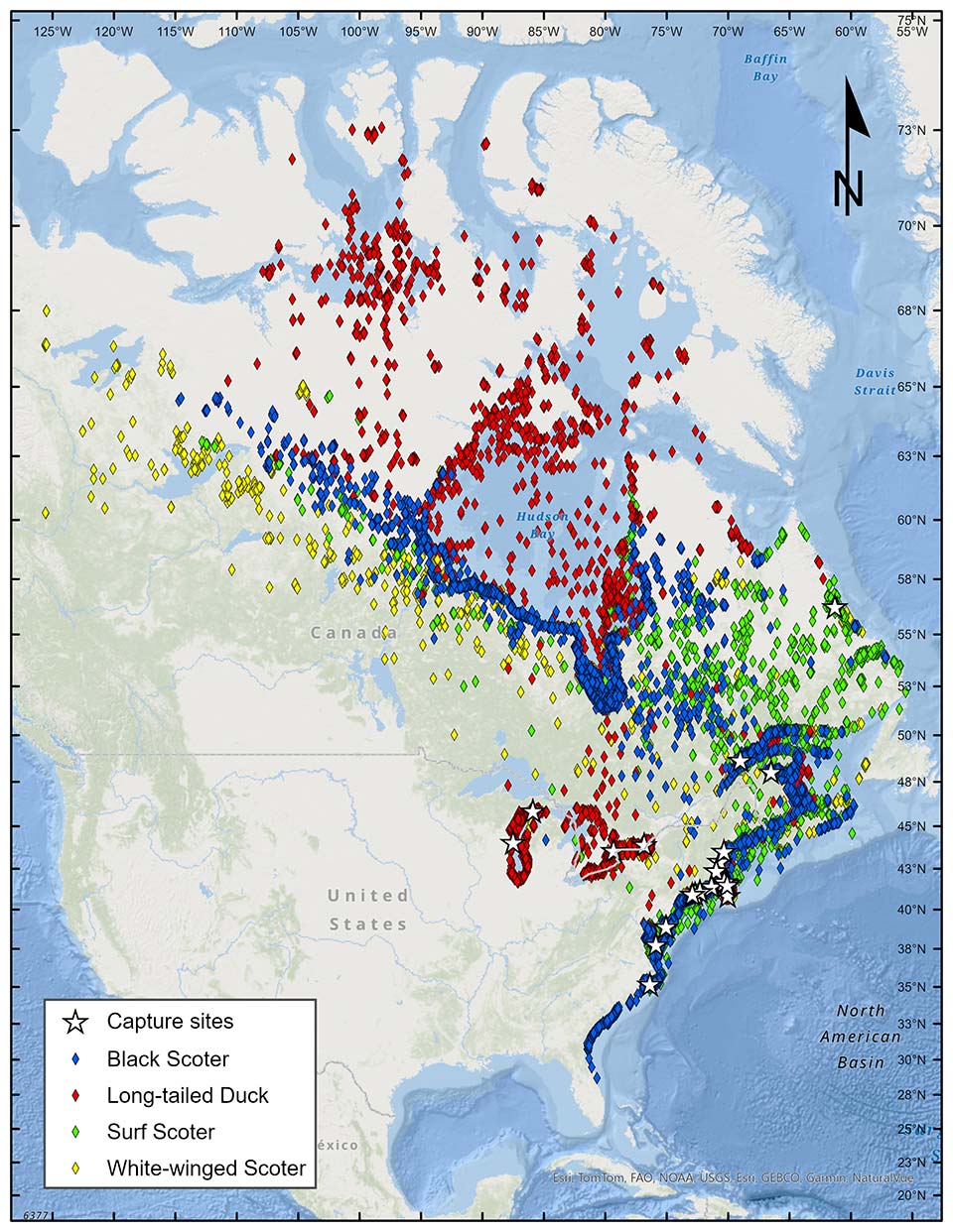
Figure 1. Geographic extent of locations determined from satellite telemetry of sea ducks marked along the Atlantic coast and within the Great Lakes. Points represent the best location per duty cycle. Locations are cumulative from October 2013 to August 2018 (all birds, all species).
The information gaps in eastern North America were of growing concern in the face of increasing hunting pressure, climate change, and interest in offshore energy development. To address these important information gaps, the SDJV launched a large-scale satellite telemetry study of sea ducks in the Atlantic and Mississippi Flyways beginning in 2009. From 2009 to 2018, over 20 partner organizations deployed more than 650 transmitters among four species: Black Scoter, Surf Scoter, White-winged Scoter, and Long-tailed Duck – all are species of high conservation concern (Sea Duck Joint Venture 2022). Outcomes of the study included:
- Fully describing the annual migration patterns for four species of sea ducks (surf scoter, black scoter, white-winged scoter, long-tailed duck) in the Atlantic flyway and Great Lakes.
- Mapping local movements and estimating length-of-stay during winter in areas proposed for placement of wind turbines.
- Identifying near-shore and offshore habitats of high significance to sea ducks to help inform habitat conservation efforts and the development of the Sea Duck Key Habitat Sites Atlas.
- Estimated rates of annual site fidelity to wintering areas, breeding areas, and molting areas for all four focal species in the Atlantic flyway.
- The resulting data set has been used for environmental assessments and marine spatial planning in both the US and Canadian Atlantic coasts.
The Methods
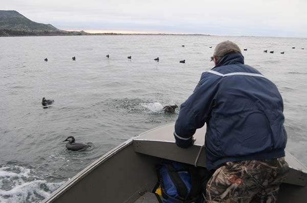
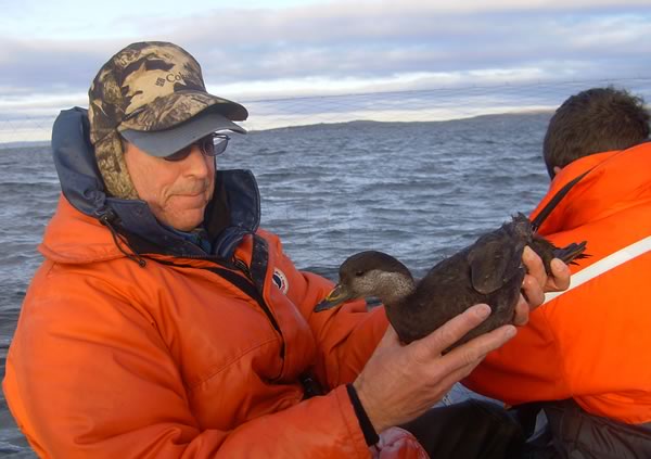
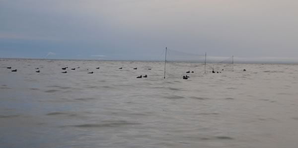
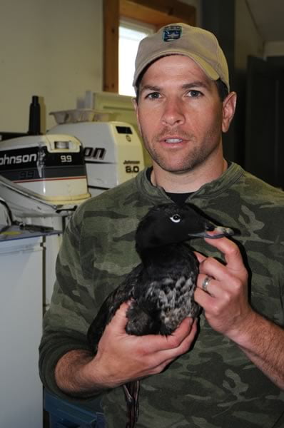
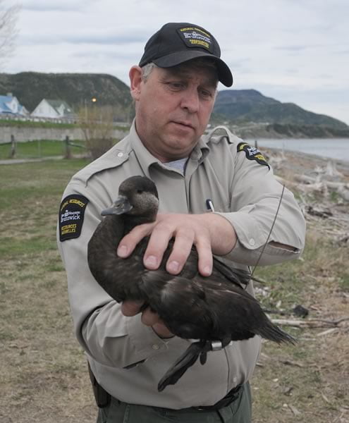
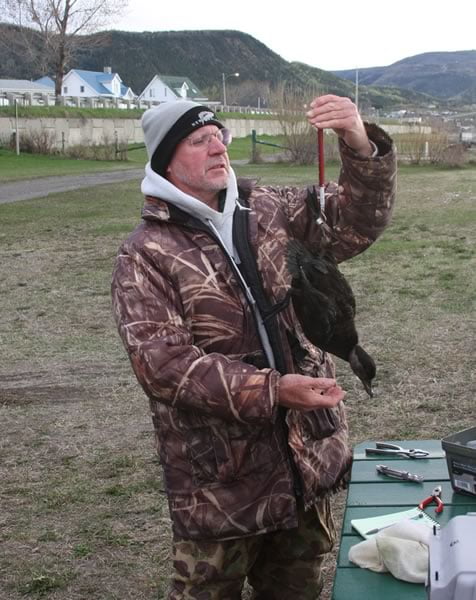
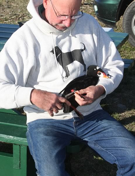
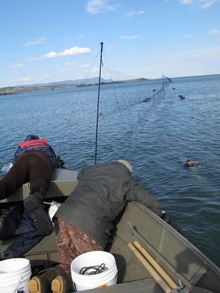
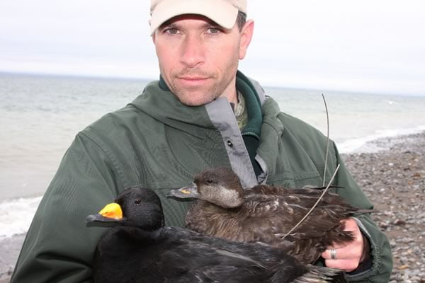
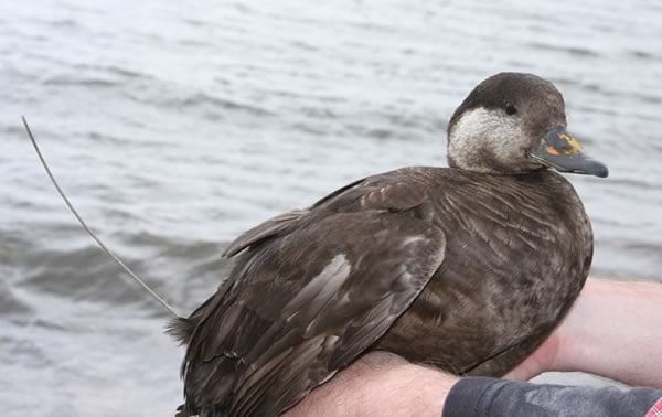
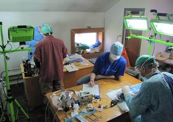
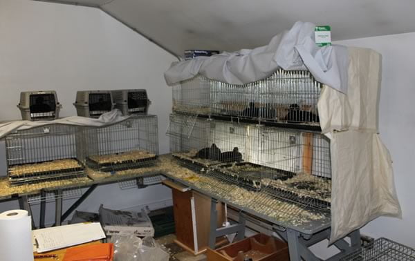
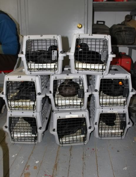
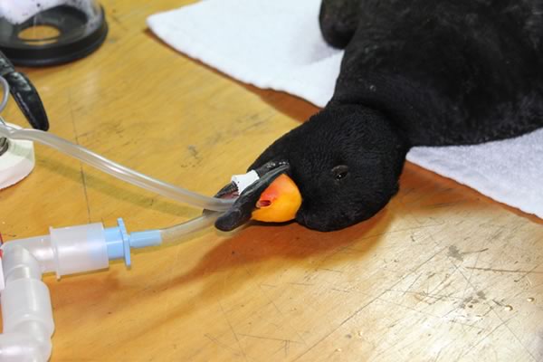
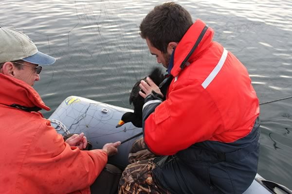
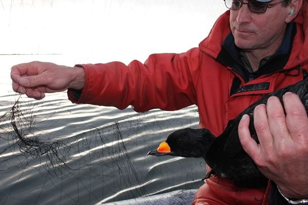
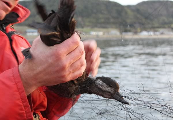
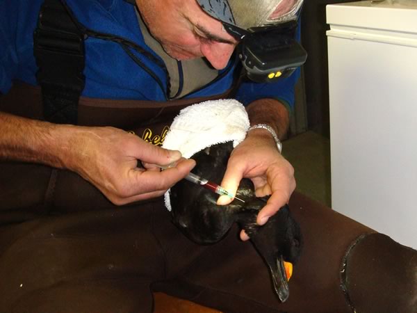
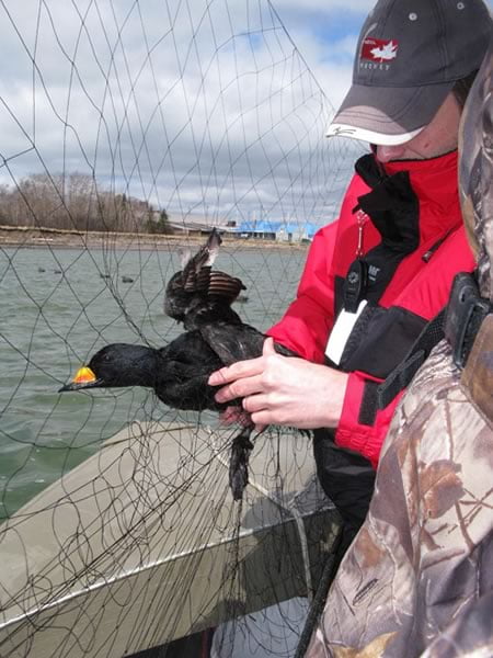
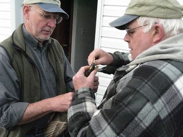
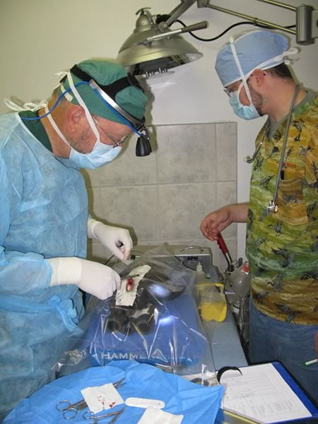
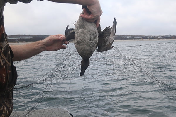
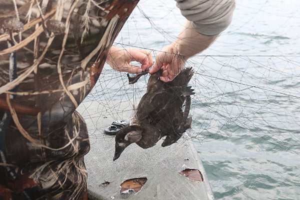
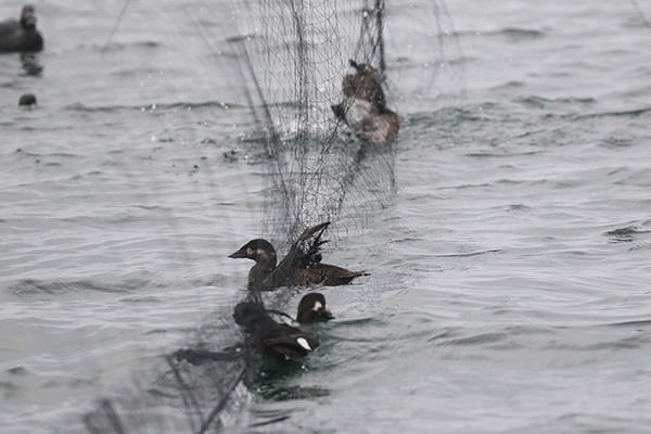
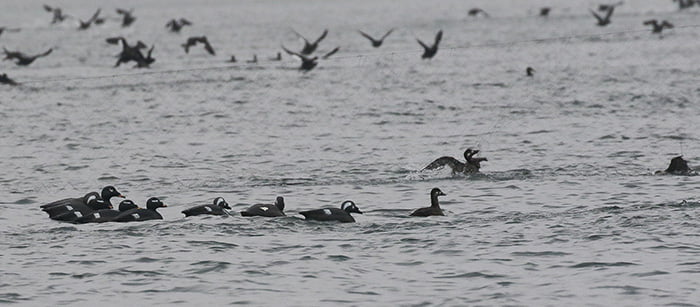
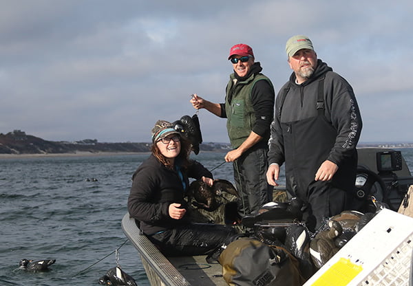
Satellite telemetry has been the primary tool used to identify breeding ranges, migration routes, molting and wintering areas, and timing of bird movements for sea ducks. In remote northern locations, satellite telemetry is the only way to generate detailed data about sea duck migration patterns because there are limited opportunities to band sea ducks during breeding, and because band returns for sea ducks are relatively low. Several methods of capture were used to successfully and safely catch sea ducks, including over-water mist nets, net guns, nightlighting, and drive trapping molting birds into special gill nets, depending on the particular species and time of year. Once birds are captured, a veterinarian surgically implanted transmitters into the body cavity of the ducks, with the antenna exiting out the duck’s lower back. Technological advances in transmitters and batteries now enable researchers to track birds for more than one annual cycle and to describe annual variability in habitat use patterns and site fidelity. Location data from marked birds were downloaded from the Argos system of satellites about every three days. Data were then uploaded to a web-based program that automatically updates maps and allows users to view the migration paths of marked birds.
The Findings
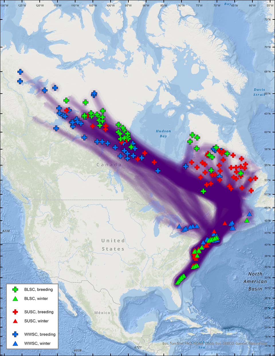
Figure 17. Spring migration routes from breeding areas (females) to wintering areas for black scoter, surf scoter, and white-winged scoter. Shaded lines between points represent a direct line between consecutive locations, but do not necessarily represent actual migration paths. Map includes all locations through 8 December 2014.
As a result of this extensive collaborative effort, the understanding of migration patterns and distribution of sea ducks in eastern North America has been greatly improved.
Areas identified as important sea duck wintering, staging and molting areas were included as key habitat sites in the Sea Duck Key Habitat Sites Atlas, a tool that can be used to prioritize areas for habitat conservation. In addition, areas were added to the Areas of Continental Significance to North American Ducks, Geese, and Swans under the North American Waterfowl Management Plan (NAWMP) 2012 Revision.
Many of these areas used by sea ducks marked in this study are not surveyed by the Waterfowl Breeding Population and Habitat Survey (WBPHS), and for those that are, the timing of the survey is inadequate for late-breeding sea duck species. Experimental aerial surveys were conducted in these areas based on this new information, and recommendations for improving spatial and temporal survey coverage of areas used extensively by scoters were developed.
The study also provided notable findings on population delineation and site fidelity of sea duck species, including the confirmation of separate Atlantic and Pacific populations of Black Scoters, emerging evidence of structuring among wintering populations of Long-tailed Ducks, and relatively low fidelity of scoters to molting areas. Capture events conducted during this study also provided biologists with an unprecedented opportunity to collect tissue samples that have been used to examine relationships among populations based on genetics and stable isotopes, screen for diseases, and determine contaminant loads. Throughout this study, capture and surgical methods were evaluated and refined, improving the likelihood of success of future telemetry projects.
In addition, data from this study was used in assessments of proposed offshore wind energy projects along the U.S. Atlantic coast, for the design of a radar migration study for a wind turbine project on the isthmus between New Brunswick and Nova Scotia, in a coastal sensitivity mapping program in South Carolina, and in a feasibility assessment for the designation of waters surrounding Torngat National Park, Labrador as an Indigenous protected area.
Results: Black Scoter
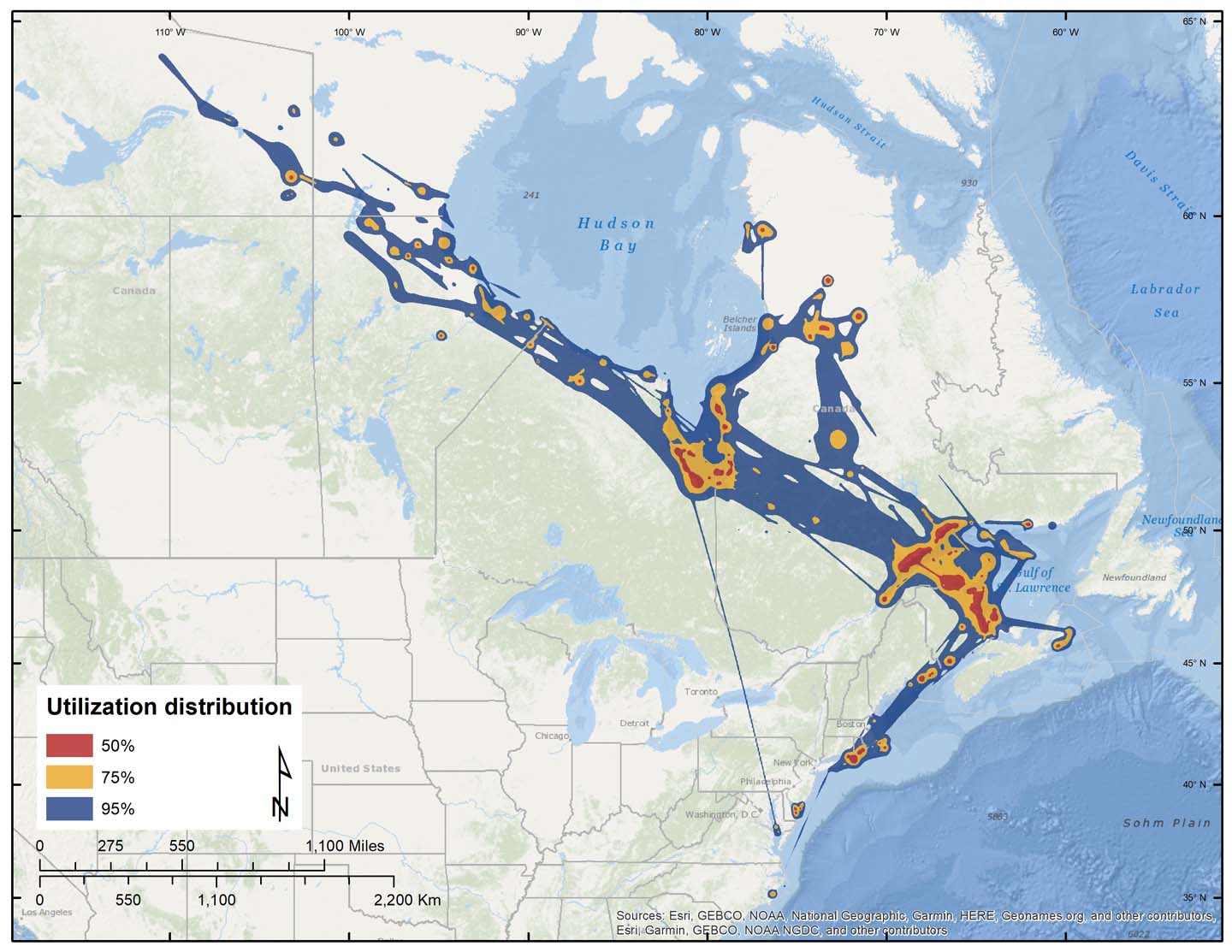
Figure 4. Dynamic Brownian-bridge movement models of spring migration and staging areas for 76 adult Black Scoters.
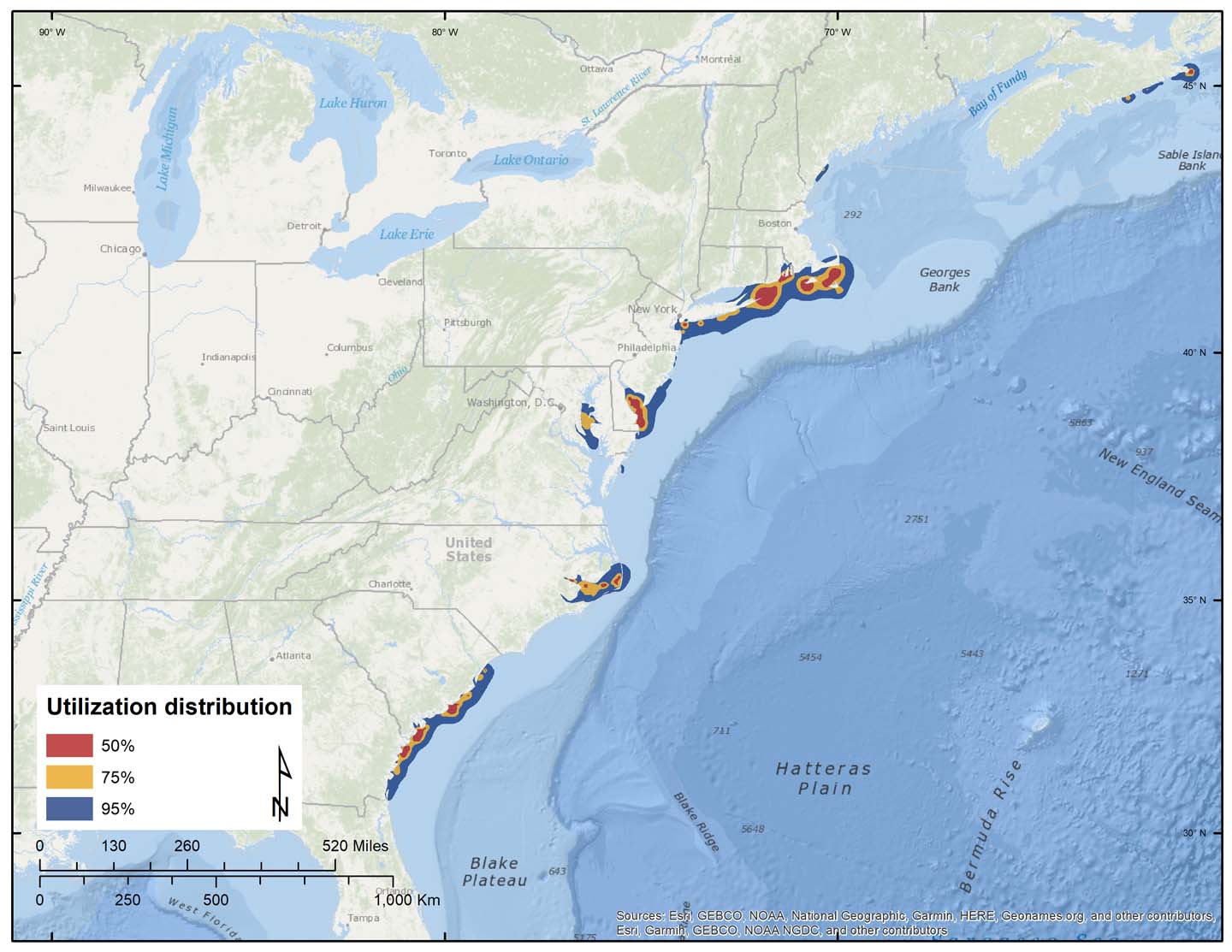
Figure 7. Dynamic Brownian-bridge movement models of wintering areas for 61 adult Black Scoters.
The telemetry data from this study have provided a completely new view of the breeding range for the species and suggest that a large portion of the eastern population is associated with breeding areas in northern Manitoba, Nunavut, and the Northwest Territories. Molting sites for males have been delineated in western Hudson Bay, James Bay, the St. Lawrence Estuary, and Labrador; there is some interchange among these sites between years for some individuals. This study also confirmed that unpaired males do not go to the breeding areas but fly directly to their molting area, and that Atlantic and Pacific breeding populations are distinct.
Results: Surf Scoter
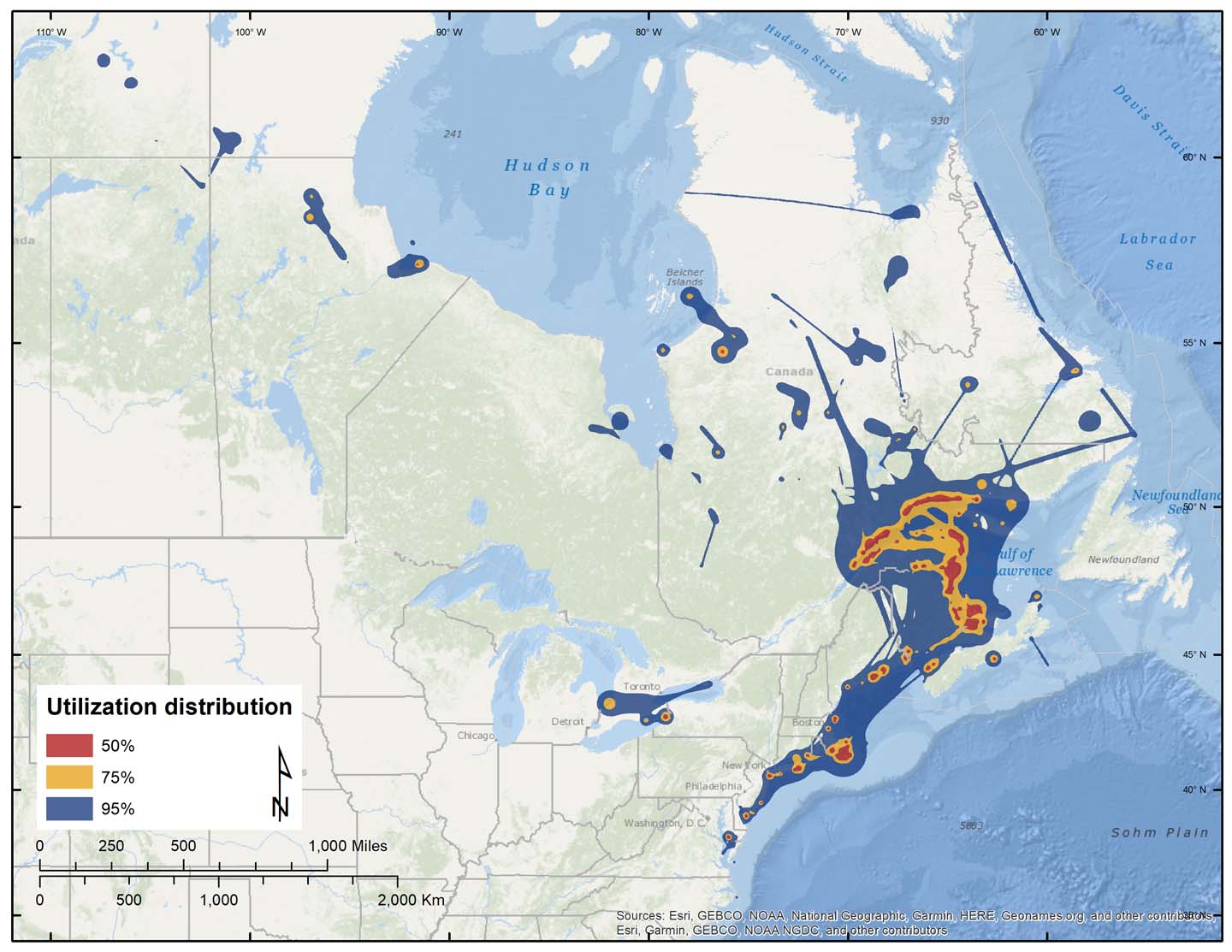
Figure 9. Dynamic Brownian-bridge movement models of spring migration and staging areas for 87 adult Surf Scoters.
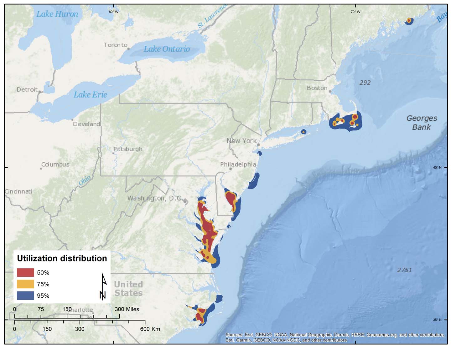
Figure 12. Dynamic Brownian-bridge movement models of wintering areas for 78 adult Surf Scoters.
This study suggests that Surf Scoters appear to exhibit strong site fidelity to wintering and staging areas, but more data are needed to better quantify fidelity to molt and breeding areas. Overall, the timing of migration appears to vary little over time. These data are being used by USFWS and BOEM to create a “risk” map of sea duck distributions to better inform the siting of offshore wind power projects along the Atlantic coast. The Northumberland Strait and St. Lawrence Estuary appear to be key bottleneck areas for Surf Scoters during spring and fall migration, and both warrant habitat conservation efforts.
The timing and use of key stopover areas could be linked to the management of aquaculture farms in those areas. Large-scale oyster restoration projects in high-use areas of the Chesapeake Bay could provide more food resources to support higher concentrations of scoters during winter.
The geographic distributions of breeding Surf and Black Scoters in eastern North America overlap throughout most of their range, with a large portion of the Surf Scoters breeding in northern Quebec and Labrador, and a large portion of Black Scoters breeding in the Northwest Territories and Nunavut. Although the breeding range of the Black Scoter generally lies north of the surf’s breeding range, it is possible that these two populations can be surveyed at the same time, providing a reliable method for speciation is used.
Results: White-winged Scoters
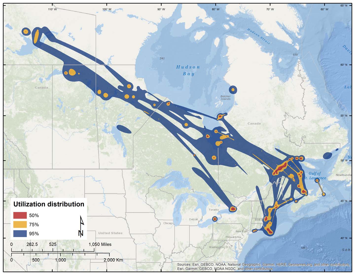
Figure 15. Dynamic Brownian-bridge movement models of spring migration and staging areas for 45 adult White-winged Scoters.
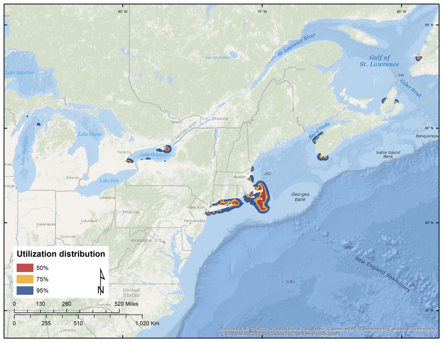
Figure 18. Dynamic Brownian-bridge movement models of wintering areas for 66 adult White-winged Scoters.
Telemetry data suggest that a large portion of the eastern wintering population of White-winged Scoters is associated with breeding areas in northern Quebec, northern Saskatchewan, northern Manitoba, and the Northwest Territories. The data also suggest that birds molting at a given location originate from several populations and have different migration patterns. White-winged Scoters exhibited strong site fidelity to wintering and staging areas, although fidelity to molting areas was variable.
Results: Long-tailed Ducks
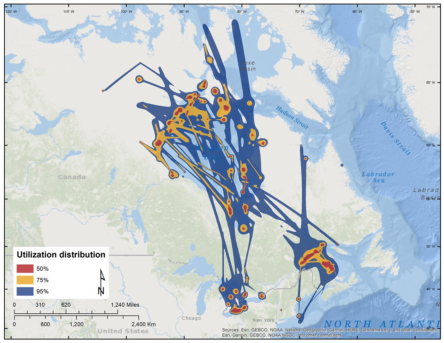
Figure 22. Dynamic Brownian-bridge movement models of spring migration and staging areas for 60 adult Long-tailed Ducks.
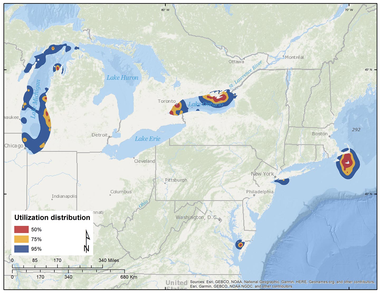
Figure 26. Dynamic Brownian-bridge movement models of wintering areas for 49 adult Long-tailed Ducks.
As with other species, key staging areas including Northumberland Strait, Chaleur Bay, Belcher Islands and St. Lawrence Estuary may warrant special management or protection. There is also emerging evidence of structuring among wintering populations of Long-tailed Ducks, one wintering primarily off the coast of Nantucket, MA, another wintering in Chesapeake Bay, MD, another wintering on Lake Michigan, and the most recent wintering at Lake Ontario. This research indicated that critical stopover and major wintering areas for Long-tailed Ducks overlap with potential offshore wind power development in the Great Lakes.
Reports and Publications
Final Report [PDF]
Progress Report – Results and overall Migration Maps – June 2015 [PDF]
General Study Information [PDF]
Related Publications
Bowman, T. D., J. L. Churchill, C. Lepage, S. S. Badzinski, S. G. Gilliland, N. McLellan, and E. Silverman. 2022. Atlas of sea duck key habitat sites in North America. Sea Duck Joint Venture March 2022.
Bowman, T.D., Gilliland, S.G., Schamber, J.L., Flint, P.L., Esler, D., Boyd, W.S., Rosenberg, D.H., Savard, J.-P., Perry, M.C. & Osenkowski, J.E. 2021. Strong evidence for two disjunct populations of Black Scoters Melanitta americana in North America. Wildfowl 71: 179-192.
Fara, L.J., S. Ford, B.R. Lubinski, S.C. Houdek, and M.W. Eichholz. 2019. Long nights, airplanes, and avian surgery: A tale of working with volunteers to study long-tailed ducks (Clangula hyemalis) wintering on Lake Michigan. Journal of Avian Medicine and Surgery 33(1):82-88.
Fara, L.J. 2018. Migration patterns, habitat use, prey items, and hunter harvest of long-tailed ducks (Clangula hyemalis) that overwinter on Lake Michigan. MS Thesis, Southern Illinois University – Carbondale.
Lamb, J.S., Cooper-Mullin, C., Gilliland, S.G., Berlin, A.M., Bowman, T.D., Boyd, W.S., De La Cruz, S.E., Esler, D., Evenson, J.R., Flint, P., Lepage, C., Meattey, D.E., Osenkowski, J.E., Paton, P.W., Perry, M.C., Rosenberg, D., Savard, J.-P.L., Savoy, L., Schamber, J., Ward, D.H., Takekawa, J.Y. and McWilliams, S.R. (2024), Evaluating conservation units using network analysis: a sea duck case study. Front Ecol Environ, 22: e2648
Lamb, J.S., S.G. Gilliland, J-P.L. Savard, P.H. Loring, S.R. McWilliams, G.H. Olsen, J.E. Osenkowski, P.W.C. Paton, M.C. Perry, and T.D. Bowman. 2021. Annual-cycle movements and phenology of black scoters in eastern North America. The Journal of Wildlife Management 85(8):1628-1645.
Lamb, J.S., P.W.C. Paton, J.E. Osenkowski, S.S. Badzinski, A.M. Berlin, T. Bowman, C. Dwyer, L.J. Fara, S.G. Gilliland, K. Kenow, C. Lepage, M.L. Mallory, G.H. Olsen, M.C. Perry, S.A. Petrie, J-P.L. Savard, L. Savoy, M. Schummer, C.S. Spiegel, and S.R. McWilliams. 2020. Implanted satellite transmitters affect sea duck movement patterns at short and long timescales. The Condor: Ornithological Applications 122:1-16.
Lamb, J.S., P.W.C. Paton, J.E. Osenkowski, S.S. Badzinski, A.M. Berlin, T. Bowman, C. Dwyer, L.J. Fara, S.G. Gilliland, K. Kenow, C. Lepage, M.L. Mallory, G.H. Olsen, M.C. Perry, S.A. Petrie, J-P.L. Savard, L. Savoy, M. Schummer, C.S. Spiegel, and S.R. McWilliams. 2020. Assessing year-round habitat use by migratory sea ducks in a multi-species context reveals seasonal variation in habitat selection and partitioning. Ecography 43:1-18.
Lamb, J.S., P.W.C. Paton, J.E. Osenkowski, S.S. Badzinski, A.M. Berlin, T. Bowman, C. Dwyer, L.J. Fara, S.G. Gilliland, K. Kenow, C. Lepage, M.L. Mallory, G.H. Olsen, M.C. Perry, S.A. Petrie, J-P.L. Savard, L. Savoy, M. Schummer, C.S. Spiegel, and S.R. McWilliams. 2019. Spatially explicit network analysis reveals multi-species annual cycle movement patterns of sea ducks. Ecological Applications 0(0):e01919.
Le Net, R., D. M. Mulcahy, A. Santamaria-Bouvier, S. G. Gilliland, T. D. Bowman, C. Lepage, and S. Lair. 2019. Intranasal administration of midazolam hydrochloride improves survival in female surf scoters (Melanitta perspicillata) surgically implanted with intracoelomic transmitters. Journal of Zoo and Wildlife Medicine 50:167 – 175.
Lepage, C., J-P.L. Savard, and S.G. Gilliland. 2020. Spatial ecology of white-winged scoters (Melanitta deglandi) in eastern North America: A multi-year perspective. Waterbirds 43(2):147-162.
Loring, P.H., P.W.C. Paton, J.E. Osenkowski, S.G. Gilliland, J-P.L. Savard, and S.R. McWilliams. 2014. Habitat use and selection of black scoters in southern New England and siting of offshore wind energy facilities. The Journal of Wildlife Management 78(4):645-656.
Loring, P.H. 2012. Phenology and habitat use of scoters along the southern New England Continental Shelf. MS Thesis, University of Rhode Island.
Meattey, D.E., S.R. McWilliams, P.W.C. Paton, C. Lepage, S.G. Gilliland, L. Savoy, G.H. Olsen, and J.E.
Osenkowski. 2019. Resource selection and wintering phenology of white-winged scoters in southern New England: Implications for offshore wind energy development. The Condor: Ornithological Applications 121:1-18.
Meattey, D.E., S.R. McWilliams, P.W.C. Paton, C. Lepage, S.G. Gilliland, L. Savoy, G.H. Olsen, and J.E. Osenkowski. 2018. Annual cycle of white-winged scoters (Melanitta fusca) in eastern North America: Migratory phenology, population delineation, and connectivity. Canadian Journal of Zoology 96:1353-1365.
Meattey, D.E. 2018. Annual cycle phenology and winter habitat use of White-winged Scoters in eastern North America. MS Thesis, University of Rhode Island.
Plumpton, H.M., S.G. Gilliland, and B.E. Ross. 2020. Movement ecology and habitat use differences in black scoters wintering along the Atlantic coast. Avian Conservation & Ecology 15(2):6.
Roberts, A., E. Silverman, and S. Gifford. 2018. Sample size considerations for satellite telemetry and animal distributions. Journal of Wildlife Management 82:1536–1544.
Sonsthagen, S. A., R. E. Wilson, P. Lavretsky, and S. L. Talbot. 2019. Coast to coast: High genomic connectivity in North American scoters. Ecology and Evolution 9:7246–7261.
Acknowledgements
U.S
USFWS, Ducks Unlimited, Massachusetts Audubon Society, Maine Department of Inland Fisheries and Wildlife; USGS Patuxent Wildlife Research Center, Dr. Malcolm McAdie, Dr. Darryl Heard, and Dr. Scott Larsen (Denver Zoo), Maryland Department of Natural Resources, Virginia Department of Game and Fish, North Carolina Department of Wildlife Management, USGS Patuxent Wildlife Research Center, Avian Specialty Veterinary Services, Wisconsin Department of Natural Resources, Michigan Department of Natural Resources, Southern Illinois University Cooperative Wildlife Research Laboratory and Zoology Department, Wisconsin Division of the Izaak Walton League of America, Delta Waterfowl, Wisconsin Waterfowl Association, and numerous volunteers.
Canada
New Brunswick Department of Natural Resources, BOEM, DOE, University of Quebec at Montreal, Environment Canada Science and Technology Branch, McGill University, Toronto Zoo, UNatural Sciences and Engineering Research Council of Canada, Ontario Ministry of Natural Resources, Ontario Federation of Anglers and Hunters, Wildlife Habitat Canada, TD Friends of the Environment Foundation
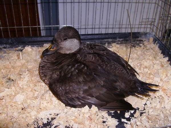
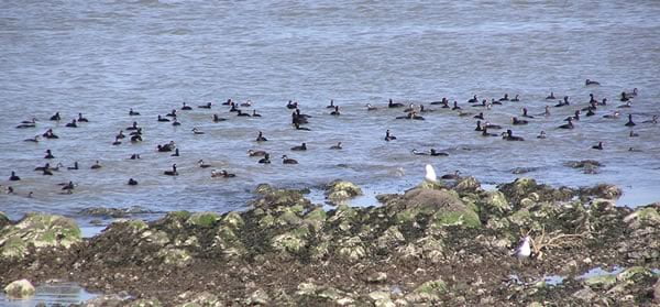
Photo Gallery
Partners


